Lyriana & Snegoviktor
 Lyriana
I’ve been poring over the legends of the earliest mountaineers who crossed the western highlands. The stories seem to mesh with the very first maps people drew of those ranges. How accurate do you think those old routes were compared to the precision of your maps?
 Snegoviktor
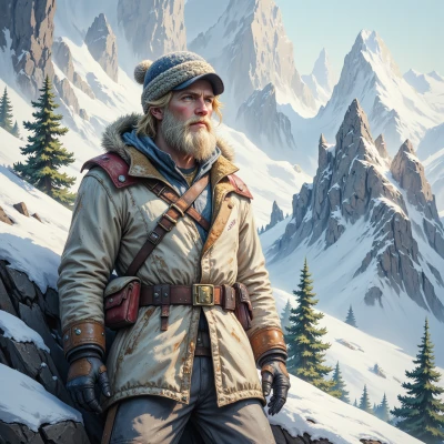
The early routes were more like educated guesses, rough sketches that people filled in as best they could. I’d say they’re about as precise as a map drawn in the dark—good enough to get you somewhere, not a place to navigate with a GPS. My maps, on the other hand, have every ridge line, snow depth, and crevasse plotted out. If you’re willing to stick to them, you’ll stay out of trouble.
Lyriana
That’s precisely why I always keep a copy of the old sketches beside the new charts—there’s a strange comfort in the imperfect lines, as if the ancients were trying to capture a feeling rather than a fact. Your maps sound almost flawless, but I suppose even a perfect line can hide a hidden crevasse if we let our curiosity wander too far. I’ll stick to yours, thank you.
Snegoviktor
Glad you see the value in both. The old sketches give a mood, the new charts give a safety margin. Stick to the map, but keep the sketches as a reminder that even a perfect line can look wrong if you ignore the wind. Stay sharp.
Lyriana
I’ll keep that in mind—balance old intuition with new precision, and stay mindful of the wind. Thank you.
Snegoviktor
No problem, just keep the rope tight and the eye on the ridge.
Lyriana
I shall remain vigilant and keep a careful eye on the ridge.
Snegoviktor
Good, keep your eyes on the ridge and your rope close. The snow doesn't care about anyone's schedule.
Lyriana
I’ll make sure the rope stays snug and the ridge stays in view; the snow waits for no one, after all.
Snegoviktor
That’s the only way to keep the climb from turning into a winter trap. Stay tight, stay focused.
Lyriana
I will keep my focus tight and the rope close. Thank you for the reminder.